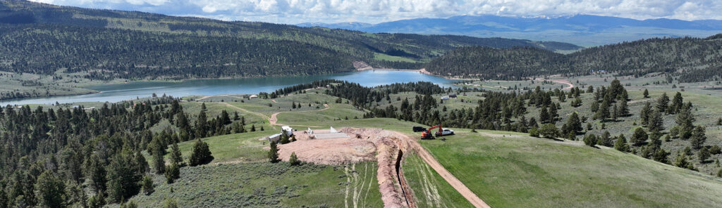
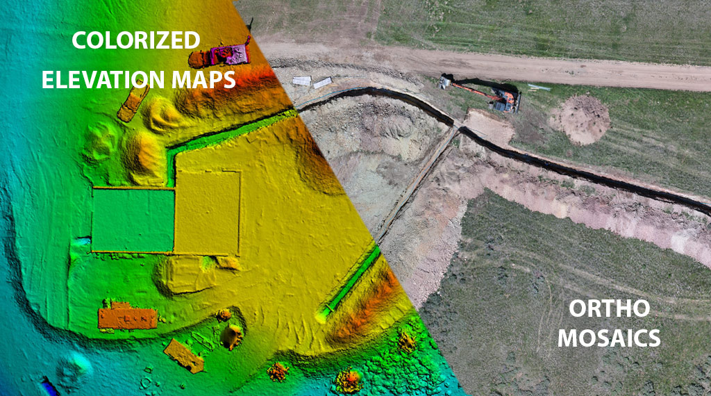
An ortho mosaic photo is essentially many photos stitched together to create a large image in high detail. This is perfect for getting a much better idea of what something looks like and help make better decisions off site. We use a drone to capture hundreds of photos, stitch them together and create both not only a high res photo, but also 2-D map, elevation map and an interactive 3-D model as well.
Ortho mosaics are perfect for construction progress reporting or large real estate property.
2-D Mapping and 3-D Modeling
We work with you closely to discover what you need from an orthomosaic map. When deciding on what you may want, the primary things to consider are as follows. How detailed do you need this map? Are you looking for just a basic site overview or do you need a more thorough analysis or even something in between? The answer to this question is also the solution to the formula we use to calculate cost. Essentially the more detail you want in the ortho, the more it will cost. By having a good conversation to understand what you are looking for, we can also guide you to make an informed decision of what ortho can meet your needs.